- Home Page /
- Office Products /
- Office & School Supplies /
- Writing & Correction Supplies /
- Technical Drawing Supplies /
- Protractors /
- Pocket Grid Accurate Easy to Read Protractor ...
0 ratings

Item #:
100298629
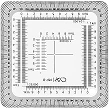
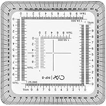
Pocket Grid Accurate Easy to Read Protractor Professional 1/24,000 Maptool for Poltting Utm, USNG, Mgrs Coordinates Outdoor Land Navigation
85% of respondents would recommend this to a friend
Item #:
100298629
ZMW 516
Price Details
Excluding Shipping & Custom charges ( Shipping and custom charges will be calculated on checkout )
*All items will import from US
0 ratings
Write a review
In stock
 Imported from USA store
QTY:
Order now and get it around Thursday, October 08
Secured transaction
Ubuy works hard to protect your security and privacy. Our advanced payment security system ensures confidentiality by encrypting your information during transmission using AES (Advanced Encryption Standards) and SSL (Secure Socket Layer) protocols. Your payment details are 100% secure as we do not share your payment details with third party sellers.
Our Top Logistics Partners


The multicoordinate position work ruler can help complete geographic study and work tasks, which is very convenient.

Fast
Shipping

Free
Return*

Secure Packaging

100% Original Products

PCI DSS Compliance

ISO 27001 Certified




Note: Step Down Voltage Transformer required for using electronics products of US store (110-120). Recommended power converters Buy Now.


What Stands Out
High Precision
Engineered for accuracy, the Pocket Grid Protractor allows users to plot UTM, USNG, and MGRS coordinates with pinpoint precision, ensuring effective land navigation in various outdoor settings.
User-Friendly Design
With its clear, easy-to-read markings and a compact design, this protractor simplifies complex mapping tasks, making it accessible for both beginners and seasoned navigators alike.
Durable Construction
Crafted from high-quality materials, the Pocket Grid Protractor is built to withstand the rigors of outdoor use, ensuring longevity and reliability during expeditions in various environments.
Product Details
| Item Weight | 0.5 lbs (230 grams) |
Who Should Buy?

-
Outdoor Enthusiasts
Ideal for hikers and outdoor explorers needing accuracy in navigation on detailed topographic maps.
-
Land Surveyors
Essential tool for professionals who require precise measurements and plotting for land assessments and surveys.
-
Emergency Responders
Useful for search and rescue teams requiring efficient navigation and quick location plotting in varied terrains.

-
Casual Users
Not suitable for those who only need basic navigation tools without complex mapping requirements.
Product Description
Pocket Grid Accurate Easy to Read Protractor Professional 1/24,000 Maptool for Poltting Utm, USNG, Mgrs Coordinates Outdoor Land Navigation
Have any Query? Chat with us
Customer Questions & Answers
-
Question:
What is the Pocket Grid Protractor used for?
Answer: The Pocket Grid Protractor is primarily used for outdoor land navigation, allowing users to accurately plot coordinates such as UTM (Universal Transverse Mercator), USNG (United States National Grid), and MGRS (Military Grid Reference System). These features are essential for hikers, geocachers, and outdoor enthusiasts to navigate diverse terrains. With its user-friendly design and accurate measurements, it's perfect for planning hikes, locating points on maps, or coordinating group activities in wilderness settings. -
Question:
How do you read the Pocket Grid Protractor?
Answer: Reading the Pocket Grid Protractor involves aligning your map with the protractor's grid lines to determine precise coordinates. First, ensure the protractor is oriented correctly with the north direction indicated on your map. Then, use the grid to plot the designated point by following the UTM, USNG, or MGRS notations. This tool provides an intuitive way for both beginners and experienced navigators to interpret maps, making it ideal for outdoor education and practical route planning. -
Question:
Is the Pocket Grid Protractor durable for outdoor use?
Answer: Yes, the Pocket Grid Protractor is built with durability in mind, often utilizing high-quality, weather-resistant materials that provide longevity in rugged outdoor environments. This robustness ensures that the protractor withstands various weather conditions and tough handling during adventures like hiking or camping. Its compact design also makes it easy to carry, ensuring that you have a reliable navigation tool available whenever you venture outdoors. -
Question:
Can I use this protractor for aerial or water navigation?
Answer: The Pocket Grid Protractor is specifically designed for terrestrial land navigation, primarily focusing on mapping and plotting coordinates on land-based maps. While its principles may apply in some scenarios related to aerial navigation, specialized tools are recommended for aviation and maritime navigation that cater to those specific systems. For land-based outdoor events such as hiking, orienteering, and trail running, this protractor proves to be an invaluable asset. -
Question:
What scales are supported by the Pocket Grid Protractor?
Answer: The Pocket Grid Protractor typically supports a scale of 1:24,000, which is standard for detailed topographic maps. This scale allows users to visualize and navigate large areas with high accuracy. Additionally, it can assist in converting various coordinate systems, aiding users who need precise mapping for diverse land navigation activities. Whether you are trekking through national parks or conducting land surveys, this scale ensures reliable plot placement and measurements. -
Question:
What features make this protractor user-friendly?
Answer: The user-friendly features of the Pocket Grid Protractor include a clear, easy-to-read grid layout, essential markings for UTM, USNG, and MGRS coordinates, and a lightweight design. These attributes ensure that even novice navigators can quickly grasp how to use the tool effectively. The transparent material also helps in aligning the protractor accurately over maps, enhancing visibility and ease of use during fieldwork or outdoor excursions. -
Question:
Who can benefit from using the Pocket Grid Protractor?
Answer: Outdoor enthusiasts, military personnel, surveyors, and educators can greatly benefit from using the Pocket Grid Protractor. It is particularly useful for those engaged in activities like hiking, backpacking, camping, andienteering, or even conducting environmental studies. With its capability to plot precise coordinates, this protractor serves as an essential tool for anyone needing accurate navigation and map reading skills in various outdoor scenarios. -
Question:
Does this protractor come with any instructional materials?
Answer: Often, the Pocket Grid Protractor will include basic instructional materials or references on how to use it effectively. These may comprise guides to understanding UTM, USNG, and MGRS coordinates, as well as practical tips for plotting points on maps. Additionally, many outdoor navigation resources and tutorials are available online to enhance your skills further, ensuring you maximize the protractor's potential during your outdoor adventures. -
Question:
Can the Pocket Grid Protractor be used for educational purposes?
Answer: Absolutely! The Pocket Grid Protractor is an excellent educational tool for teaching map reading and navigation skills. Schools, outdoor education programs, and scouting organizations can integrate it into their curriculum to help students grasp the essentials of geographic coordinate systems and land navigation. Its practical application can enhance learning outcomes while engaging students in outdoor activities and exploration. -
Question:
Where can I buy the Pocket Grid Accurate Easy to Read Protractor?
Answer: You can purchase the Pocket Grid Accurate Easy to Read Protractor from Ubuy. Ubuy is a well-known online retailer that provides a wide selection of outdoor navigation tools, including this professional-grade map tool. By shopping at Ubuy, you can find the Pocket Grid Protractor along with other essential navigation equipment, ensuring you have everything you need for your outdoor adventures.
IEUDNS Protractors Editorial Review
No editorial reviews found
Customer Reviews & Ratings
1 customers ratings
-
5 Star
100%
-
4 Star
0%
-
3 Star
0%
-
2 Star
0%
-
1 Star
0%
Review this product
Share your thoughts with other customers
Pros
- High accuracy for measurements
- Compact and portable design
- Easy-to-read markings
- Versatile for various coordinate systems
- Great for outdoor navigation
Cons
- May take time to master usage
Platform Trust & Buyer Confidence

JG
Jazz
Verified buyer
“Easy to use and always helpful and sorts any issues I've had past and present”
1 September 2026 · via Trustpilot
EK
Emmanuel
Verified buyer
“I always receive support when I engage customer service. Overall my experience with UBUY has been top notch. Keep up the good work.”
31 August 2026 · via Trustpilot
F
fnd
Verified buyer
“The delivery was fast and the product came undamaged and authentic.”
29 August 2026 · via Trustpilot
LC
Leana
Verified buyer
“Ubuy is extremely efficient and to order online is an easy process. The verity of products to buy is really unlimited! My order was urgent and I got it on time. The products are great! Thank you Ubuy!”
25 August 2026 · via Trustpilot
HL
Hengo
Verified buyer
“Fast, convenient and cheap. Great store!”
27 August 2026 · via Trustpilot
Secure Checkout
Global Delivery
Easy Returns
Genuine Products
Product Price History
Important information
- Limitations : For products shipped internationally, please note that any manufacturer warranty may not be valid; manufacturer service options may not be available; product manuals, instructions, and safety warnings may not be in destination country languages; the products (and accompanying materials) may not be designed in accordance with destination country standards, specifications, and labeling requirements; and the products may not conform to destination country voltage and other electrical standards (requiring use of an adapter or converter if appropriate). The recipient is responsible for assuring that the product can be lawfully imported to the destination country. When ordering from Ubuy or its affiliates, the recipient is the importer of record and must comply with all laws and regulations of the destination country.
- Not all the products listed on Ubuy are for sale, as Ubuy is a global search engine. Products are subject to export/trade regulations.
ZMW 516
Order now and get it around Thursday, October 08
This item is not restrict in my country.(Please click on above link if this item is not restrict in your country, So our team will review and allow.)
QTY:
Secured transaction
PCI DSS compliant and ISO 27001:2022 certified, with encrypted payments and full buyer protection on every order.
Our Top Logistics Partners
Fastest cross-border delivery
Features & Benefits
- Clearly visible scale for easy operation.
- Compact size of 2.75 x 2.75 inches for portability.
- Compatible with UTM, MGRS, USNG, and other metric grids.
- Works well in conjunction with other protractors.
- Ideal for maps with scales of 1:24,000, 1:25,000, and 1:50,000.
- Made of lightweight acrylic material for convenience.
Ubuy Assurance
Experience worry-free shopping with 100% original products, PCI DSS-compliant payment security, ISO 27001-certified data protection, the fastest cross-border delivery, free returns *, and secure packaging on every order.